Every year, the monsoon season, particularly in July, brings tropical storms that result in heavy rainfall in northern Thailand. This often leads to flash floods that have a severe impact on local communities. One of the vulnerable areas is Chiang Muan District in Phayao Province, where the "Lam Nam Pi" stream flows through. Despite being a vital source of water for the local people, this small waterway can easily overflow during intense rainfall, causing widespread damage to lives, properties, and the local economy.
.jpg)
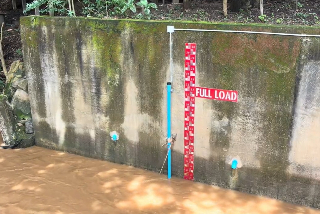
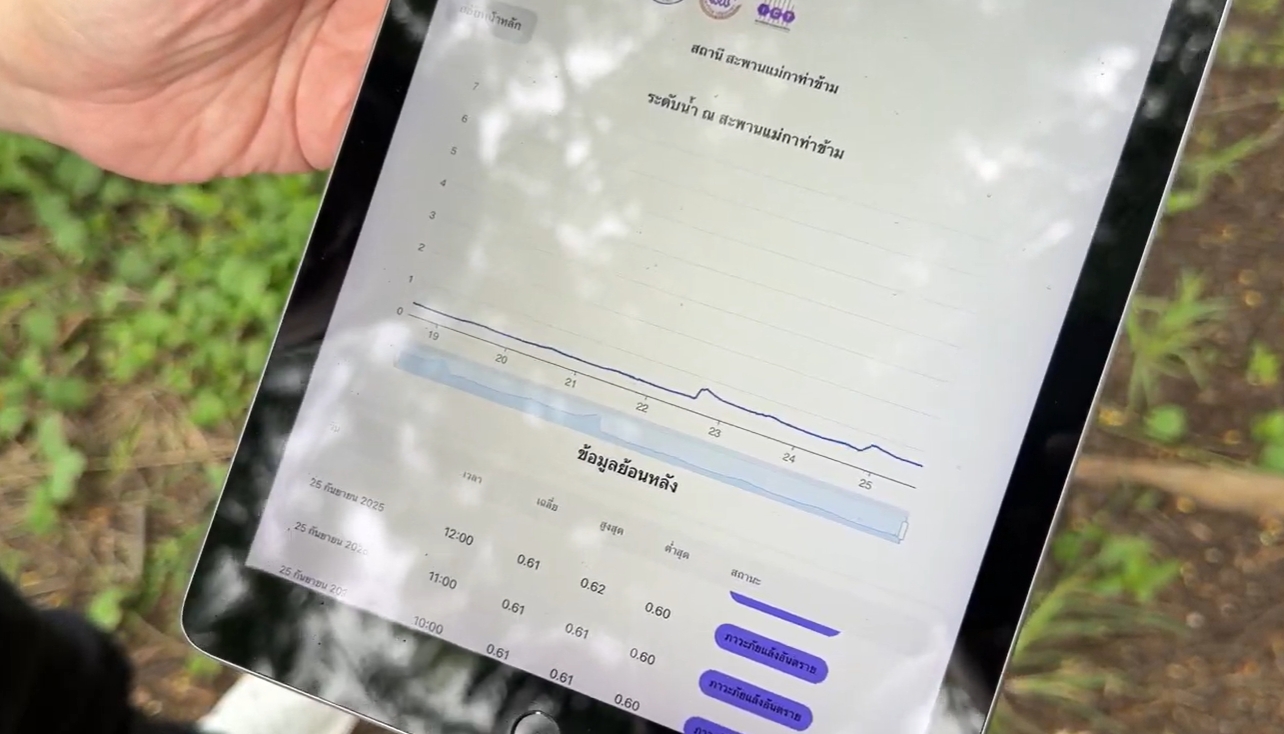
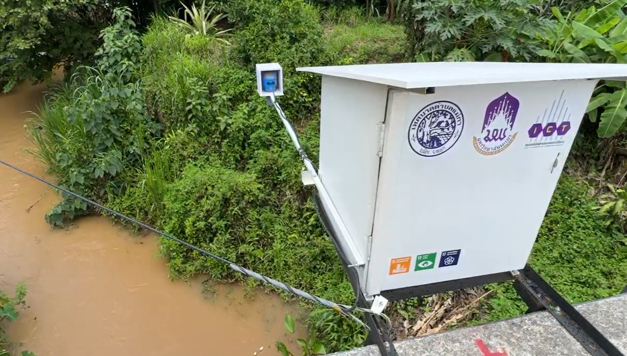
To improve disaster response, the Chiang Muan Subdistrict Municipality collaborated with the Poverty Alleviation Foundation and the University of Phayao to develop the "Lam Nam Pi Model." This prototype smart city initiative applies technology for systematic flood monitoring and management. Water level monitoring stations have been installed in key economic zones, and their data is transmitted in real-time through an application and the websitehttps://chiangmuan.igovapp.com/waterlevel. The system uses a color-coded display: Green (Normal), Yellow (Warning), and Red (Emergency). This enables authorities and residents to prepare and respond promptly for potential floods.

Core Components of the System
The model operates on three key systems:
- Real-Time Water Level Monitoring – Ultrasonic sensors are used to measure water levels, temperature, and humidity. The data is automatically transmitted every 5 minutes through IoT and WiFi, allowing for second-by-second monitoring.
- Automated Flood Warning System – When water levels exceed defined thresholds, alerts are immediately sent through the LINE application to local residents and authorities.
- Data Management and Forecasting – AI analyzes real-time and historical data to forecast trends, providing accurate insights for disaster preparedness and planning.
Additionally, drone technology is employed to survey the terrain from above, comparing geographic data with actual water levels. This enhances the accuracy of flood and drought predictions across affected areas.
Impact and Expansion
The “Lam Nam Pi Model” has proven to be more than just a technological solution. It demonstrates that smart city development is achievable even in small rural communities when the technology is tailored to local needs and accessible to residents. Building on its success in Chiang Muan, the project is being expanded to areas around the University of Phayao, which frequently suffers from recurrent flooding that affects businesses, dormitories, and students.
Collaboration for Sustainable Development
This initiative is the outcome of a collaboration between Chiang Muan Municipality, the Poverty Eradication Foundation, and the Faculty of Information and Communication Technology at the University of Phayao. It has been made possible through the active involvement of researchers, faculty members, and new-generation graduate students. This project is in line with the United Nations’ Sustainable Development Goals (SDGs), specifically SDG 11 (Sustainable Cities and Communities), SDG 13 (Climate Action), and SDG 17 (Partnerships for the Goals).
A Model for the Future
The success of the “Lam Nam Pi Model” illustrates that effective disaster management does not always require grand or costly technologies. Instead, it requires relevant, practical, and inclusive solutions supported by strong collaboration among government agencies, academia, local authorities, and the community. This model stands as a pioneering example of how Thai technology can safeguard lives, strengthen resilience, and drive sustainable smart city development for the future.
.jpg)